
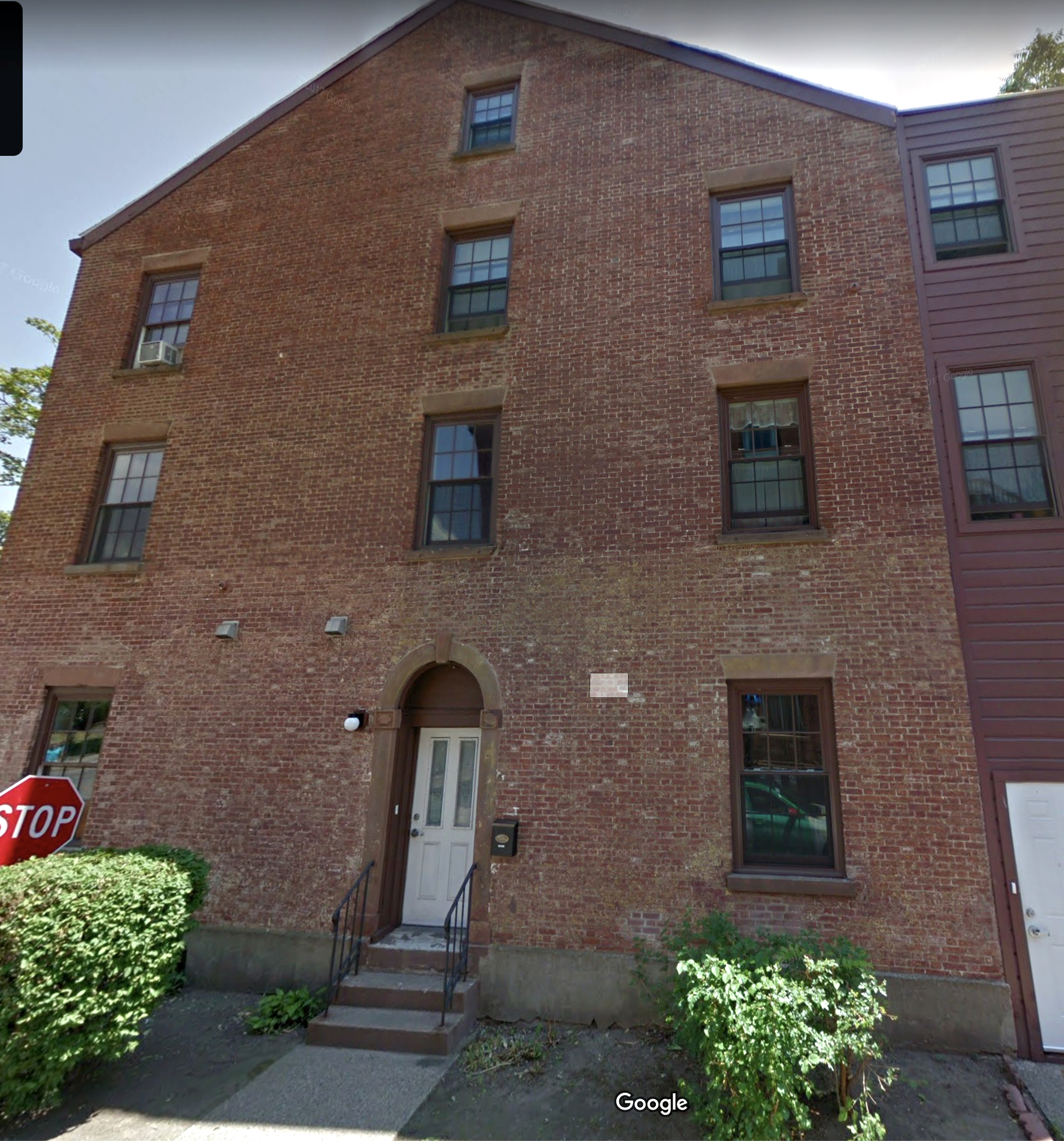
We have another minor commemorative tablet placed during Albany’s celebration of the bicentennial of its charter, in 1886 – this one for Franklin Street, which was a bit more of a complete street then than it is now. Although the building this marker was placed on is still there, which is pretty remarkable, the marker itself is gone.
Tablet No. 40—Franklin Street
Bronze tablet, 7×16 inches, corner Franklin and Madison avenue. Inscription: “Franklin Street, formerly Frelinghuysen Street.”
This was placed on the southeast corner. The building is still there, but the tablet has disappeared. It was still on the building in 1914, when The Argus took inventory of the markers, which as far as we know was the last time anyone tried to inventory the markers before Hoxsie took this project up.
As the marker said, the street was previously named Frelinghuysen, no doubt for one of mid-18th century Albany’s more colorful and controversial remnants of the Dutch old guard.
According to Joel Munsell’s extremely useful “Annals of Albany,” the Dutch Church’s Rev. Theodorus Frelinghuysen took the pulpit in August, 1744.
“Ardent in his disposition, eloquent in his preaching, animated and zealous in his conversation, and frank and popular in his manners, he thought it his duty to awaken in very breast that slumbering spirit of devotion, which he considered as lulled by security, or drooping in the meridian of prosperity, like tender plants in the blaze of sunshine.”
[Munsell vol. 1].
As part of the old guard of Dutch residents who were fighting against a tide of New Englanders, Frelinghuysen was particularly outspoken on the evils of theater, which brought him both derision and threats, and that seems to have undone his mind. In 1760, Frelinghuysen traveled to Holland in an effort to raise interest in establishing a college for the training of ministers for the Dutch churches in the colonies, and perhaps to find reinforcements against creeping English manners; he perished on the return trip. Munsell repeats two stories that say that Frellinghuysen may have committed suicide – he had “appeared silent and melancholy to his shipmates, and walked constantly on deck. At length he suddenly disappeared, leaving it doubtful whether he had fallen overboard by accident, or was prompted by despair to plunge into eternity.”
Maybe it was nothing personal against Frelinghuysen that the street was renamed – it appears to have happened about 1805, when Albany streets were being improved, extended and generally renamed. (We provided detail when writing about Washington Avenue, formerly King and Lion streets). It seems natural enough to name a street here for Benjamin Franklin, given his history with the city and the Albany Plan of Union, and around the time of the Albany Bicentennial in 1886, Franklin Street ran from its northern reach at Madison Avenue all the way down to Gansevoort – and, on paper, at least, it extended onto Van Rensselaer Island. That was then truly an island; today the Island Creek has long since been filled in and all that land is part of the Port of Albany, but it doesn’t appear that Franklin ever made it from being a dotted line on the map to being a real street in the port.
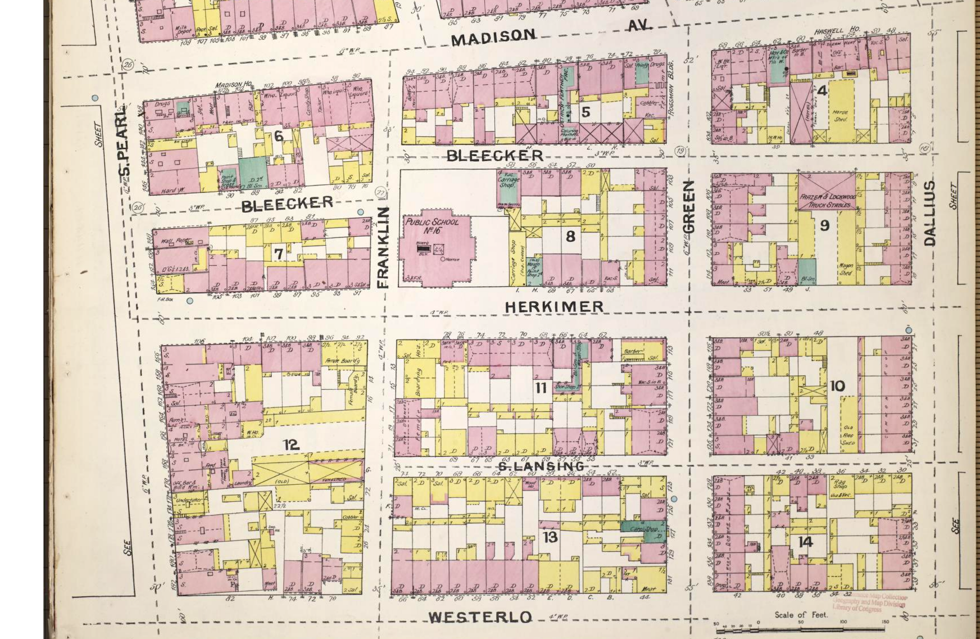
So what was along Franklin in 1892, when Sanborn mapped it for insurance purposes (and close enough to 1886 for our purposes)? At the north end, where it began at a T with Madison, were buildings fronting on Madison that still stand today. They were then a wholesale liquor distributor (west side) and a bakery (east). A block below, at Bleecker’s dogleg intersection, P.S. 15 stood on the east. (Bleecker isn’t really a street there anymore, and the school’s property is open green space.) On the next block, below Herkimer, female boarding houses lined both sides of the street, then private dwellings appear below S. Lansing.
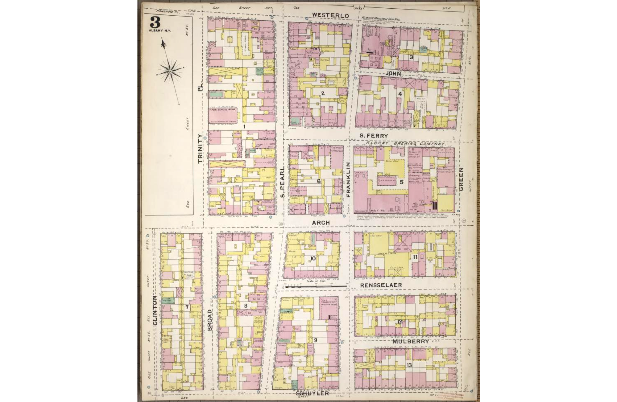
Below Westerlo, the area became industrial, with the Albany Malleable Iron Works on the east side, dwellings and a coal yard on the west. Below S. Ferry, a synagogue and several dwellings lined the west side, but the massive Albany Brewing works took up the entire block from S.. Ferry to Arch. On the blocks below that, things got mostly residential, with some corner saloons and the Albany City Mission mixed in.
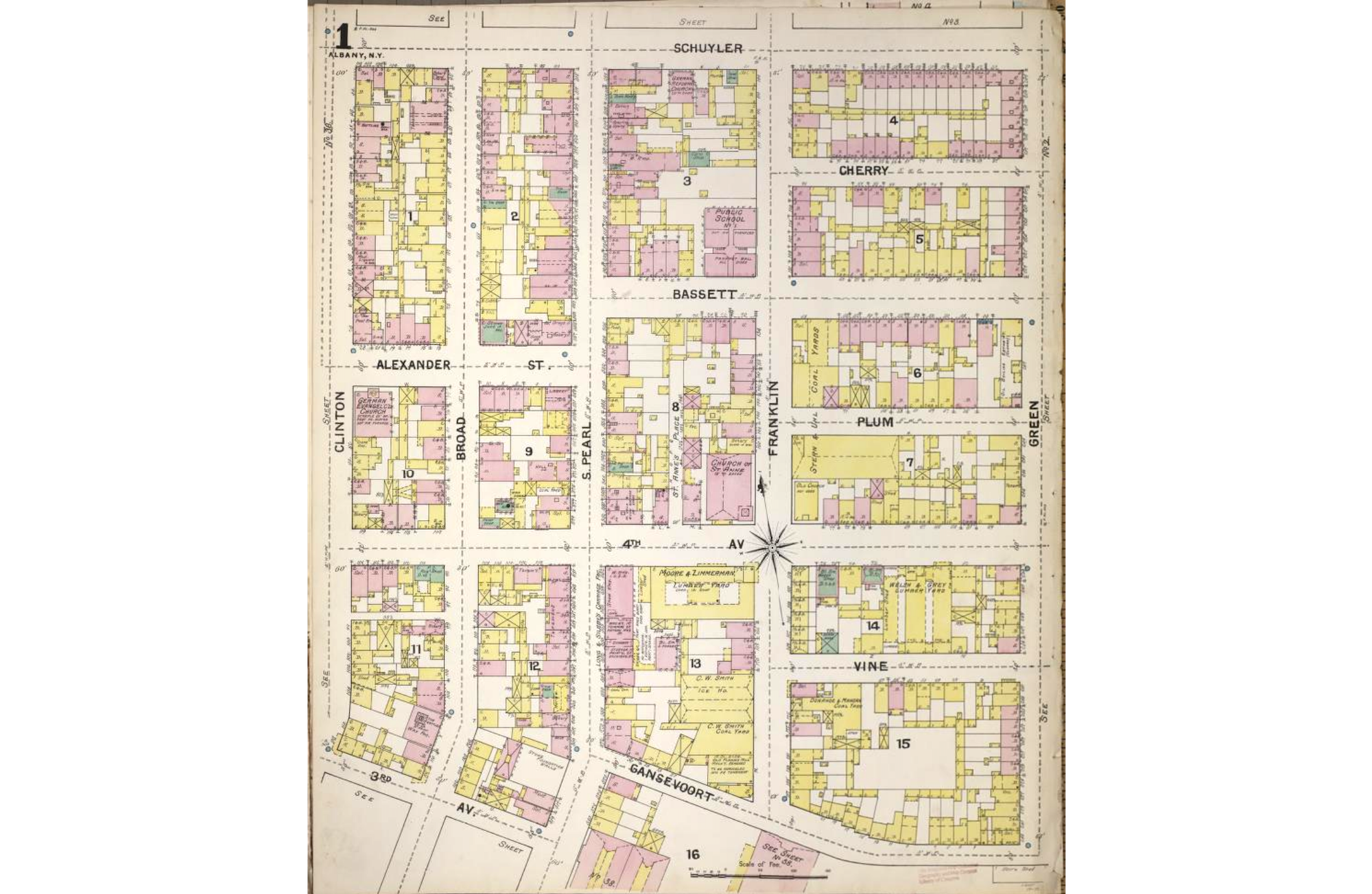
Down at Bassett Street, P.S. No. 1 was on the west side of the street, directly across from a saloon, but otherwise mostly surrounded by houses. Stern & Uhl had major coal yards from Bassett halfway to Fourth Ave. At Fourth, the Church of St. Anne, which still stands, was on the west side, while “Old Church – Not Used” was on the east. On the block below, was the Moore & Zimmerman Lumber Yard, the C.W. Smith Ice House, the C.W. Smith Coal Yard, and an old planing mill that in 1892 was “to be remodeled into fr[ame] tenement.” On the other side of the street, houses and saloons.
Today, Franklin Street is broken up. It runs south from Madison Avenue to Westerlo, where it continues as a walkway for a third of a block before returning to street status, though it’s primarily access to parking lots at that point, down to South Ferry. It disappears again for two blocks and re-emerges at Schuyler, where it runs three blocks down to Gansevoort and then comes to a stop.