
Continuing our series on the bronze markers that were placed by the Albany Bicentennial Committee in 1886. The Committee on Monumenting and Decoration chose to commemorate Broadway, then as now the major north-south street through the city.
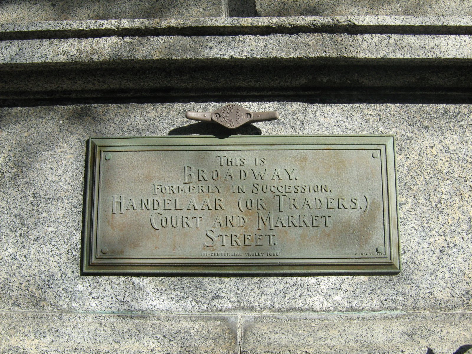
Tablet No. 3—Broadway.
Located on ground front of Government building, on Broadway near corner of State—Bronze tablet 12×30 inches inserted in die of the pedestal to the column looking up State street, inscribed:
“This is Broadway formerly in succession Handelaers or Traders, Court and Market street.”
The “Government” building is the United States Government Building, also known as the Old Post Office, right at the foot of State Street. It was only about three years old (built from 1879 to 1883) when the bicentennial plaque was put up. This building replaced the older Exchange Building, and was meant to house the Post Office and several other government offices. The building was designed initially by William A. Potter, Supervising Architect of the Treasury, followed by James Hill. The Post Office moved next door when the U.S. Courthouse opened around 1934, but other federal offices remained here until 1972; the building was vacant for several years before being taken over by SUNY. Of course, now the Old Post Office is the Old Old Post Office, the New Post Office is the Old Post Office, and the main downtown post office is in a parking garage on a side street.
We’re happy to say that this one remains in place, though the copy was altered somewhat from what appears in the report of the Bicentennial Committee.
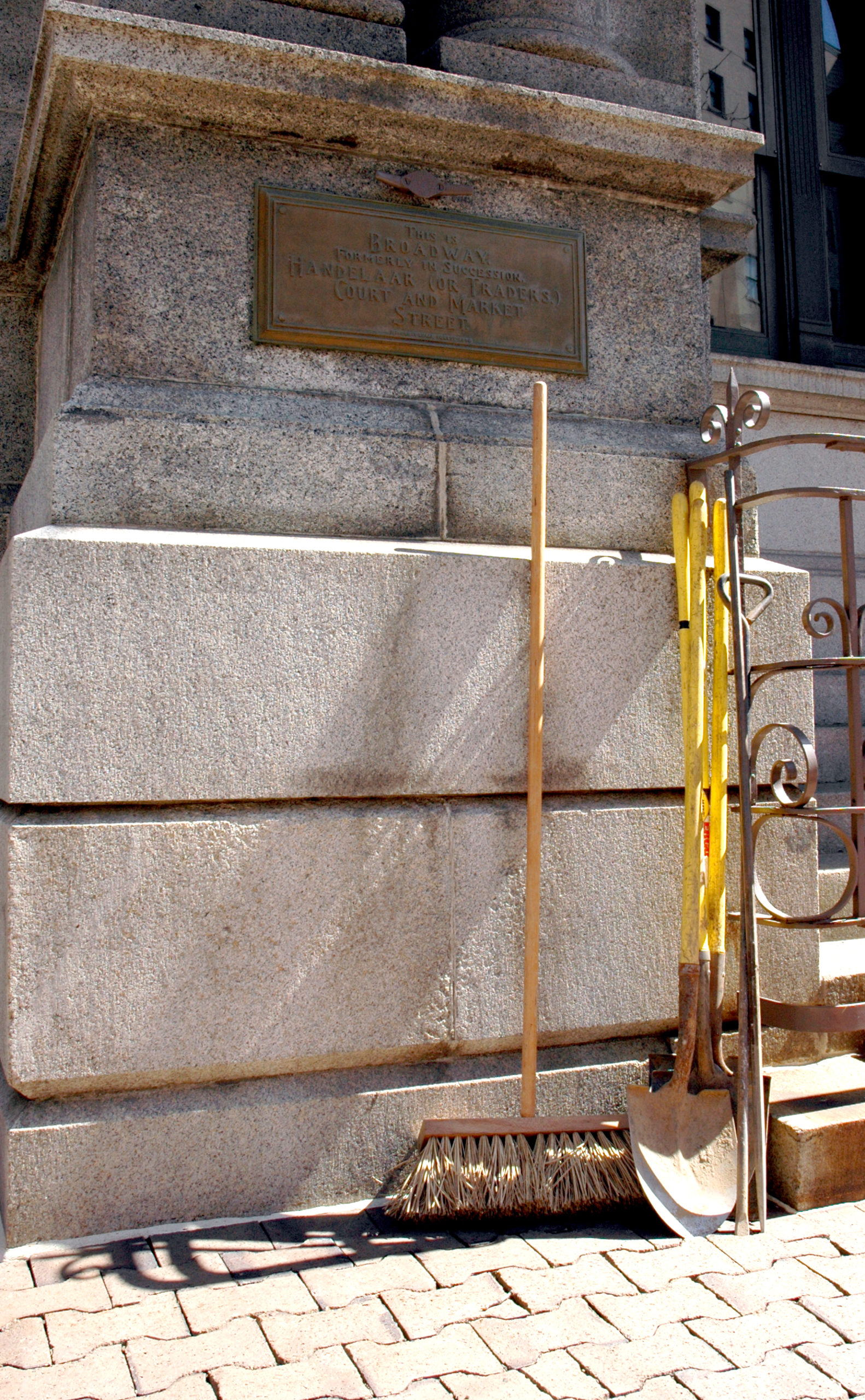
This photo borrowed from Paula Lemire, because my best shot (below) was photobombed by a broom and some shovels.
It seems pretty safe to say that Broadway was Albany’s first street. In the earliest days of Rensselaerswijck, the Patroon actually sought to have his colonists settle on the east side of the river, in Greenbush, a bit away from (and out of potential conflict with) the holdings of the West India Company at Fort Orange, the major beaver trading post. Venema writes in “Beverwijck: A Dutch Village on the American Frontier, 1652-1664,” that two guardians of the Patroon made the decision to shift the focus of settlement over to the west wide, near the fort, which led to building permits being issued for houses around 1648 which started being built north of the fort toward the “first kill,” the Ruttenkill, and then to what was called the Maquas (Mohawk) path, which is modern State Street. Prior to that there was a small cluster of houses outside the fort, probably separated by some lanes of some sort, but this set of permits strung along the path that would be Broadway, up to where it intersects with State Street.
This immediately led to a conflict with the fort; Peter Stuyvesant wanted all buildings within a cannon shot of the fort cleared (for traditional fort defense). This went on for some time, with the Patroon’s agent Brant Van Schlichtenhorst offering inducements to people to move to the ‘bijeenwoninge,” a term meaning “living together,” establishing the church in the Patroon’s storehouse, licensing a tavern, and ensuring that one owner would suffer no loss for building on the Ruttenkill. Van Schlichtenhorst was eventually jailed, the Patroon’s brother Jean Baptist Van Rensselaer became the director of Rensselaerswijck in 1653, and the West India company seized and claimed the bijeenwoninge and called it “Beverwijck.”
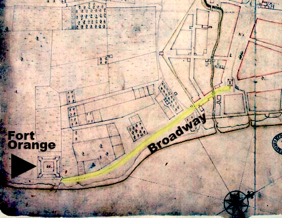
Their patents extended along the same path, which Venema says was often called simply “the street,” and which also carried the appellations “Handelaersstraet” (Merchants Street), “Coestraet” (Cow Street) and “Brouwersstraet” (Brewers Street). While we have no trouble envisioning merchants and brewers on the same street, the cows may present some confusion, but cows were commonly kept there, walked between the church (at the foot of State Street) and The Pastures. In 1654, residents were given permission to fence off the road and form a corral for the cattle (so long as they allowed a footpath on each side). Hence: Coestraet.
If you have even the slightest interest in the development of Albany as a city, Hoxsie insists you read Venema’s fabulous book.
3 thoughts on “Albany Bicentennial Tablet No. 3 – Broadway”