
Hoxsie’s busy with storm duty this week. (I suppose if one is into history, one must be into historic storms.) So, it’s Map Week. Look at pretty pictures.
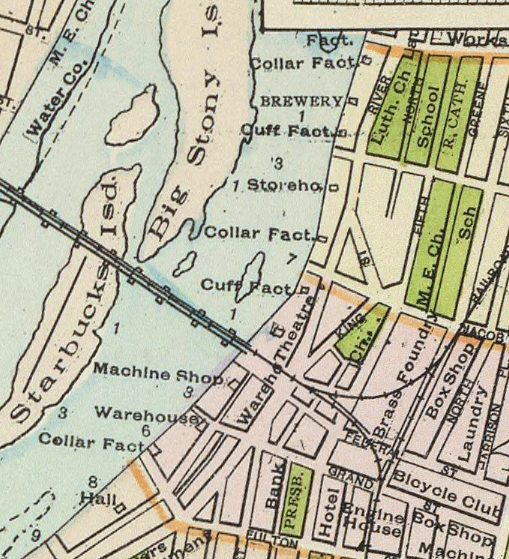
These are from an 1891 map by Watson & Co., which made maps with such detail that in the areas out of the cities individual homes are listed. This is Troy’s waterfront, just above the modern Green Island Bridge. The river was dotted with collar factory, brewery, cuff factory, storehouse, collar factory, cuff factory . . . and it did go on down the Hudson.
Starbucks Island was the home of Starbuck Brothers Iron Works, which cast iron that still holds up bridges across the country.