
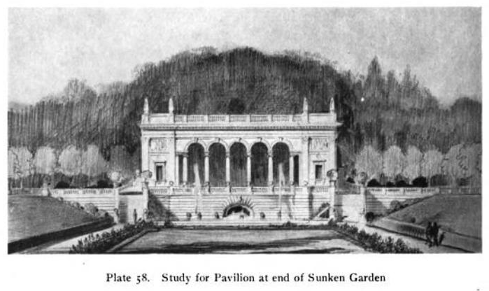
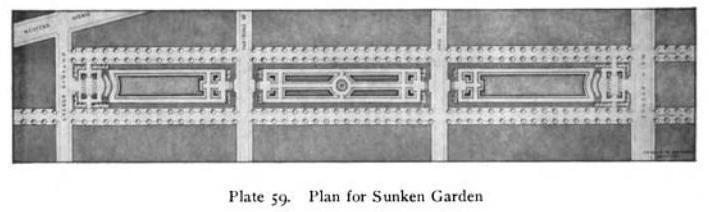
Back in 1914, Arnold Brunner’s “Studies for Albany” presented an ambitious plan for a park that would be called “Sunken Garden.” Brunner wrote that the three blocks between Lancaster and Chestnut streets, from Main Avenue to Ontario, had been acquired by the city of Albany; “The rectangular form of this piece of land seems to dictate a formal treatment.” And you couldn’t get more formal than the “Study for Pavilion at end of Sunken Garden” proposed by Brunner, shown here.
The “Municipal Journal and Engineer” revealed that this “sunken garden” was made possible through the construction of a major municipal sewer, the longest concrete sewer ever constructed in Albany at the time, over 3,000 feet long. The sewer eliminated an open creek that passed through the land, which had “for years carried away practically all of the sewage of the Pine Hills district.” The article also noted that “The lowest portions of the tract probably will be converted into a dumping grounds and later trees set out under the direction of the superintended of parks. This will give the trees an opportunity to grow and the city an opportunity to fill in all ravines.”
Brunner at once presented a grand vision, and acknowledged it was unlikely to come to fruition: “The design is perhaps unnecessarily ambitious and ornate . . . but the scheme may be much simplified and the main characteristics still be retained. As the cost of maintenance of flowers, paths and streets in a city is considerable, some of the details and sub-divisions may be omitted and an expression of a Sunken Garden secured by the sloping sides and lawns at a level lower than the streets.”
Sunken Garden (or Gardens) was referred to in numerous documents in the early part of the 20th century. So where did it go?
Well, it’s there. Kinda. Google Maps refers to part of it as “St. Mary’s Park,” reflecting its previous ownership by the Albany Catholic Diocese. It appears from satellite as a series of soccer, football, and baseball fields, with a few tennis courts thrown in, behind Albany High School.