We worry sometimes that in this digital age, knowledge of the world as it is is ephemeral. Perhaps this will change and there will be a realization of the need to document what we know and what we think we know in something other than alterable electrons. When our children and grandchildren want to reconfigure the world as it was when they were growing up, what will they turn to? There are no city directories, no phone books, no maps.
No maps. For the first time since reproduction was possible, we aren’t creating tangible representations of the world as we understand it. Sure, there are still some paper maps being made, almost exclusively for the purpose of navigating by motor vehicle. But the maps that really show what is where, that denote specific buildings or residences, those are gone. Google maps has democratized aerial/ satellite views for everybody and introduced the miracle of StreetView — but when they decide to update the images, the old ones are likely just gone. Future researchers who want to know what used to be there will simply be out of luck (or worse, at the mercy of the terrifically fallible memories of the hivemind).
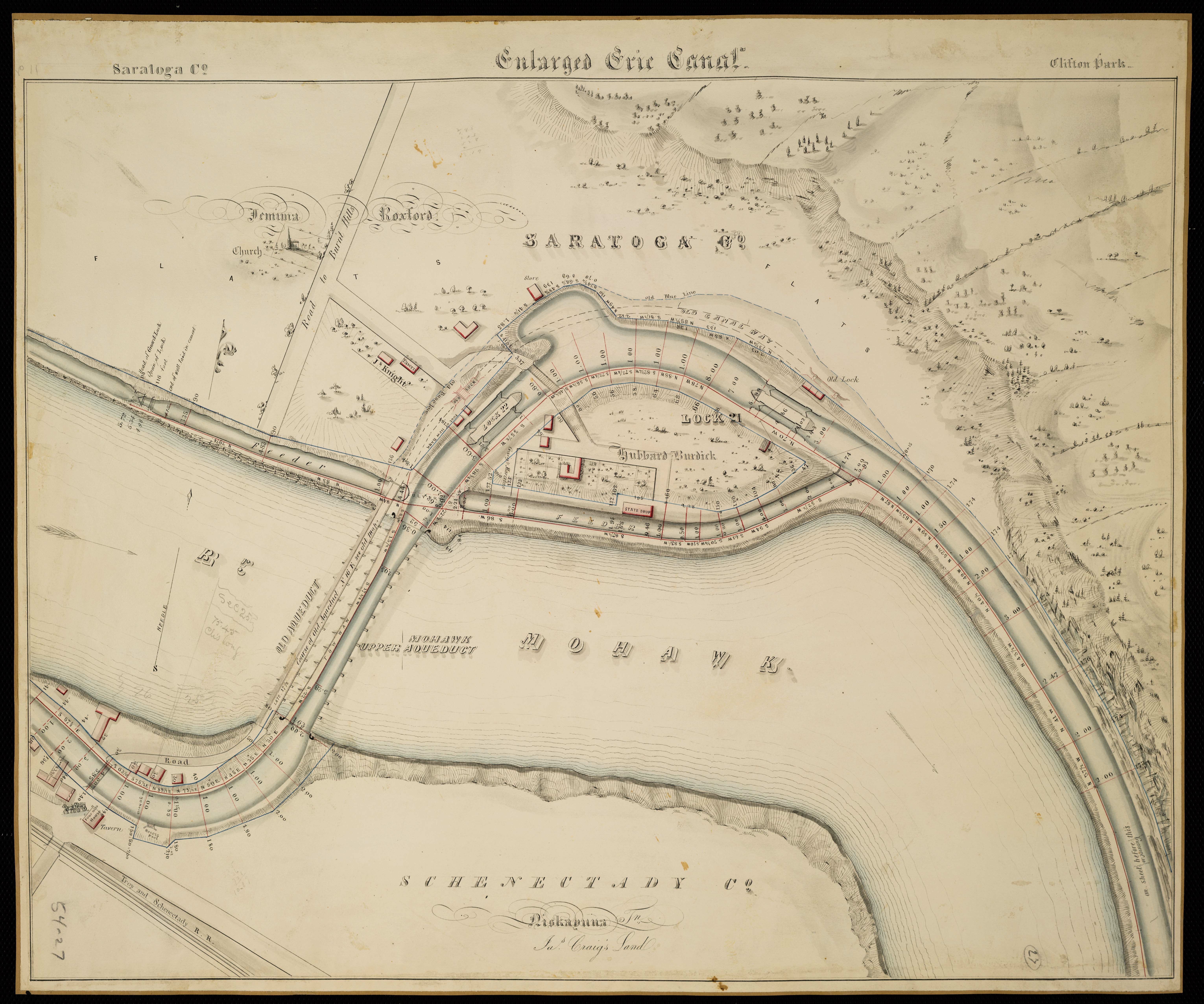
For a long time, though, we’ve been deprived of the incredible beauty that maps can provide. To be sure, some modern paper maps are graphically pleasing, even elegant, especially when compared to what was possible when color printing was prohibitively expensive for local mapmakers. But they have nothing on something like this beauty: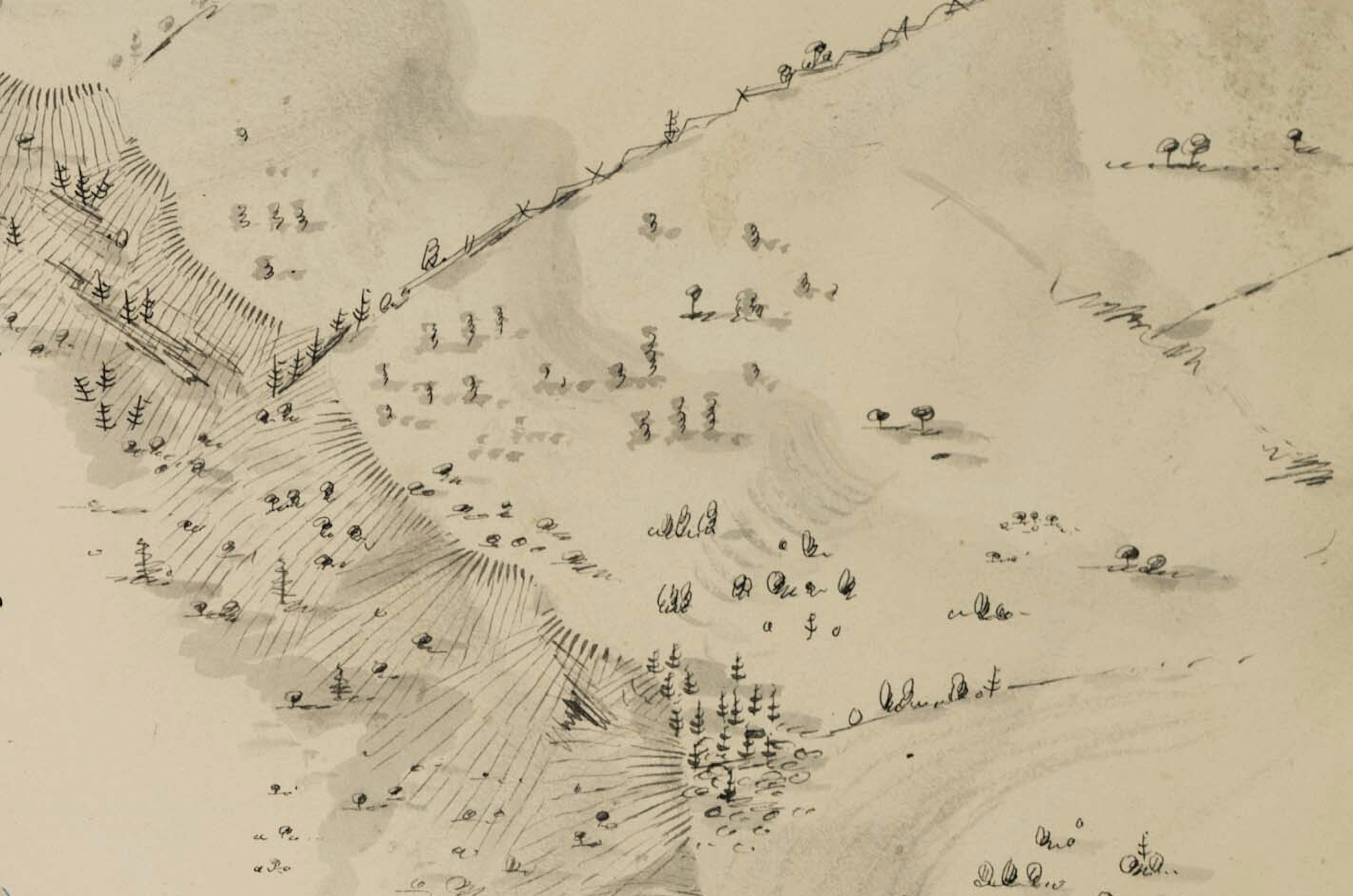
Yeah, that’s a map. Or at least part of one. Depicting some topography, woods, possibly a fenceline. It’s just gorgeous pen and brush work. (How it was reproduced, we have no idea.)
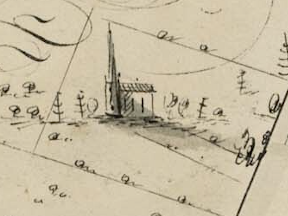
Just look at this lovely church, located just up the hill from the river on the “Road to Burnt Hills.”
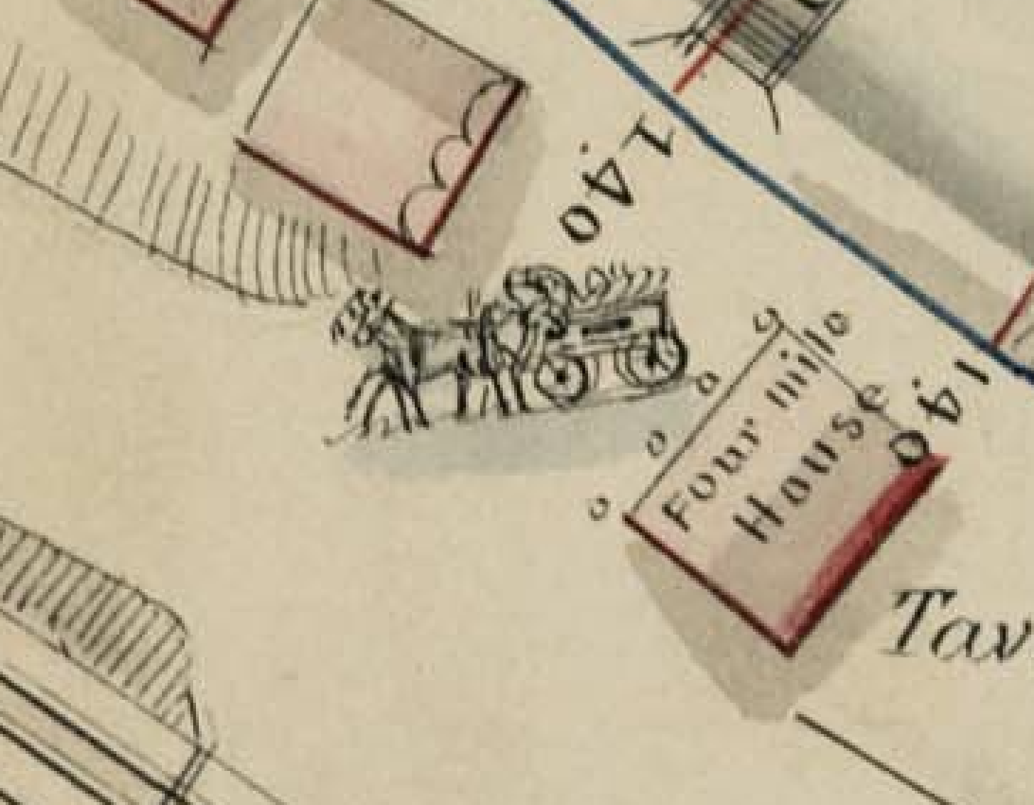
And, at the Four Mile House (and tavern?), this team and wagon.
They’re all on this beautiful map, posted by Paul Garrow over on the Schenectady History Facebook page. The date is uncertain, though since it shows the newer aqueduct and its predecessor, it’s at least post-1842, when the newer structure was in place. (Or possibly drawn with the plans for the enlargement of the canal.)
Leave a Reply to carljohnson Cancel reply