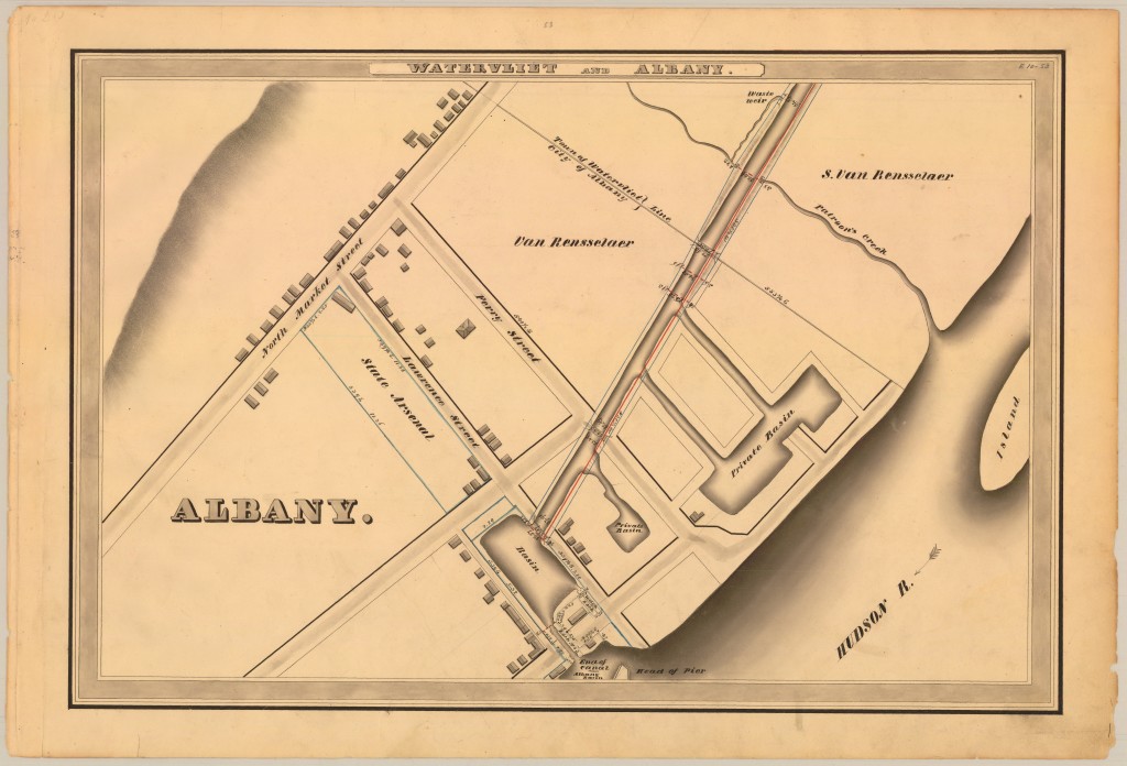
From the NYS Archives, a detailed survey of the Erie Canal from 1834. These are beautiful maps of ink, wash and charcoal. Click on them to see them in simple but glorious detail. This first one shows the beginning of the Erie Canal, and with the alignment of Lawrence Street we can see now that the lock was almost precisely at the southern end of today’s boat launch. (The historical marker for the canal is significantly closer to the Livingston Avenue Bridge; that and some other diagrams from the time could lead one to think the lock was nearer to Colonie Street. Clearly it wasn’t.) At this point, the canal had been open 11 years, but there is no sign of what would become the lumber district. There are only a few buildings in this part of the city at all, though a number are lined right up against the basin. Up at the corner of Lawrence and North Market (which wasn’t Broadway yet) is the State Arsenal that was built in 1799 and converted to School No. 13 in 1859. The lands above are all part of the Van Rensselaer estate.
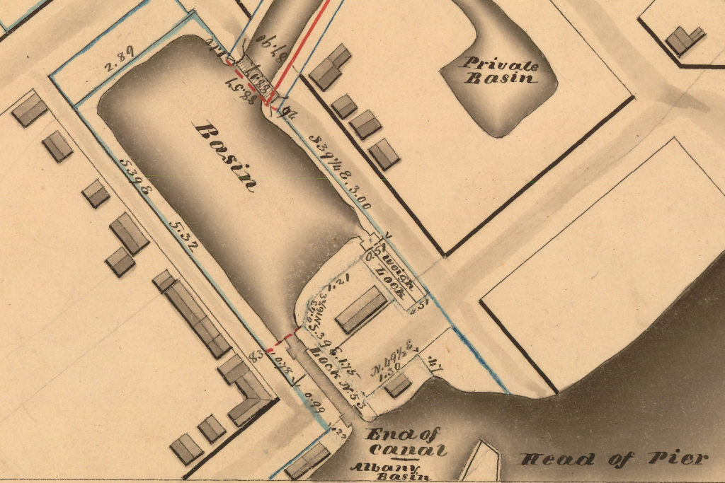
There is some beautiful detail here, including the positioning of the lock, the location of the weigh lock, and the angle out of the basin into the canal itself. Later the weighlock would be moved up and parallel to the entry to the canal, as shown in this map of the Lumber District.
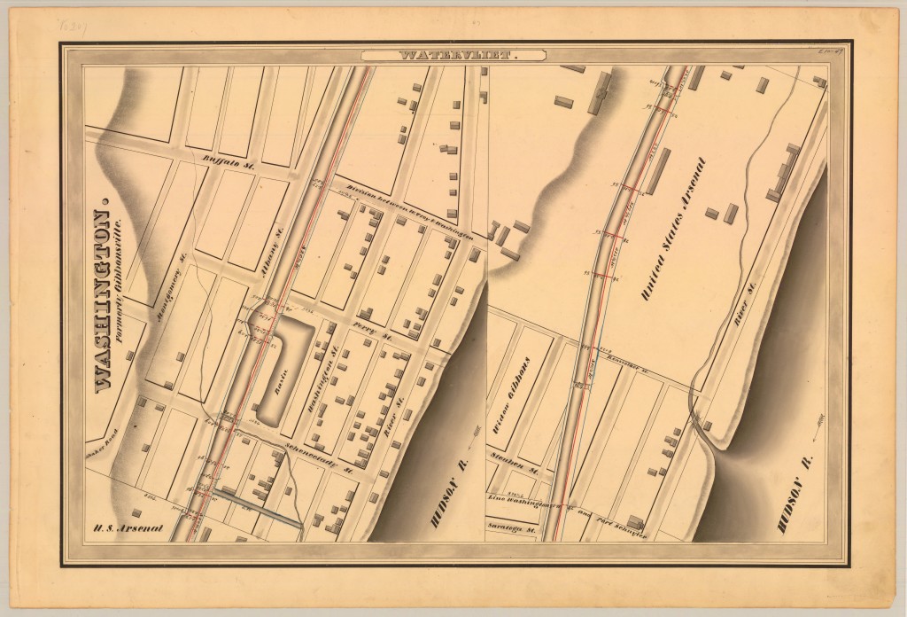
Further up the canal, the map gets a little confused, at least in terms of what it is mapping. It calls this stretch of Watervliet (the name of the town we now know as Colonie) by the name of “Washington. Formerly Gibbonsville.” But Phillip Schuyler named this area Washington in 1793; it was after it was purchased by James Gibbons that it became known as Gibbonsville. It was Gibbons who sold 12 acres of land to the United States for what was first known as the Arsenal at Gibbonsville. (Also confusingly, the left side of the map is properly read as the top of the right side.) All of this, of course, is now Watervliet the city (not Watervliet the town, which doesn’t exist anymore).
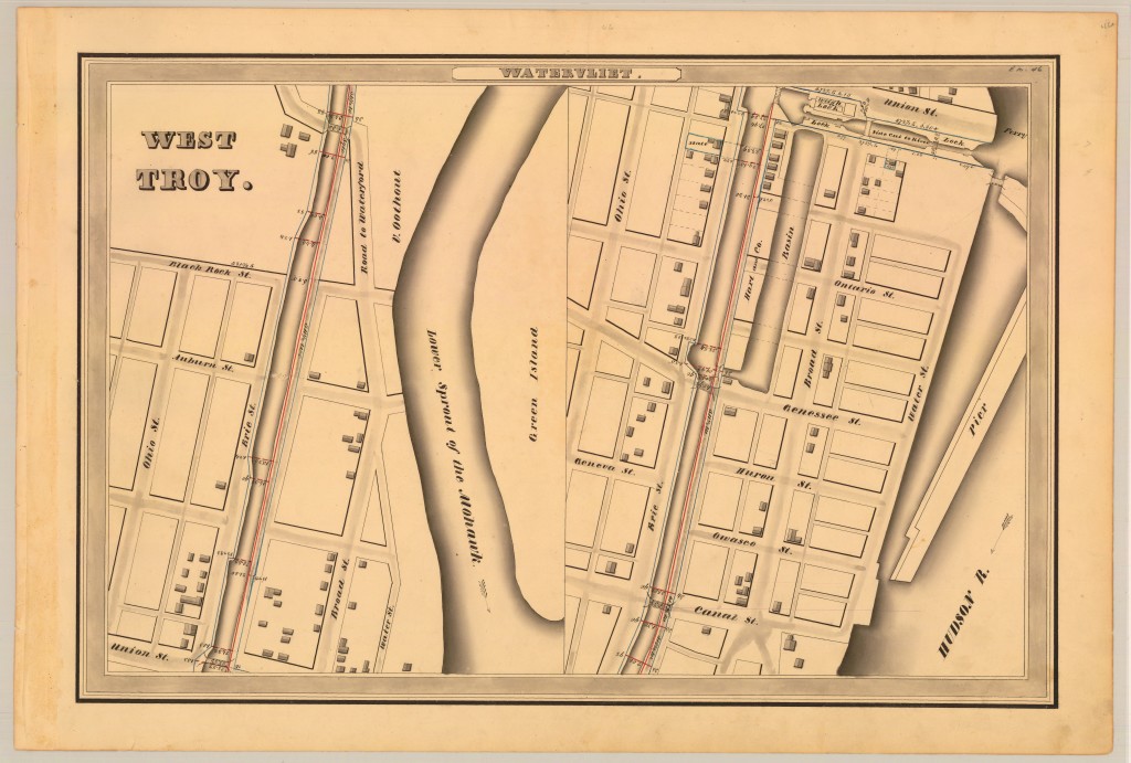
Still more northward, West Troy and Green Island. All the street names have changed. Union Street was just about where Watervliet’s 23rd Street is today and, interestingly, the basin there had a connection to the river. Later that pier in the river ran under the Congress Street Bridge (which connected to Genesee Street) and formed what was called the Lower Basin; above that was the State Basin, which was part of the south branch of the Mohawk River.


Leave a Reply