
Another view from the sky, courtesy of the New York State Archives’ Fairchild Aerial Surveys collection. Thanks to the presence of a number of notable landmarks, an awful lot of this view from June 2, 1948, looks just like Albany today. And a lot of it does not.
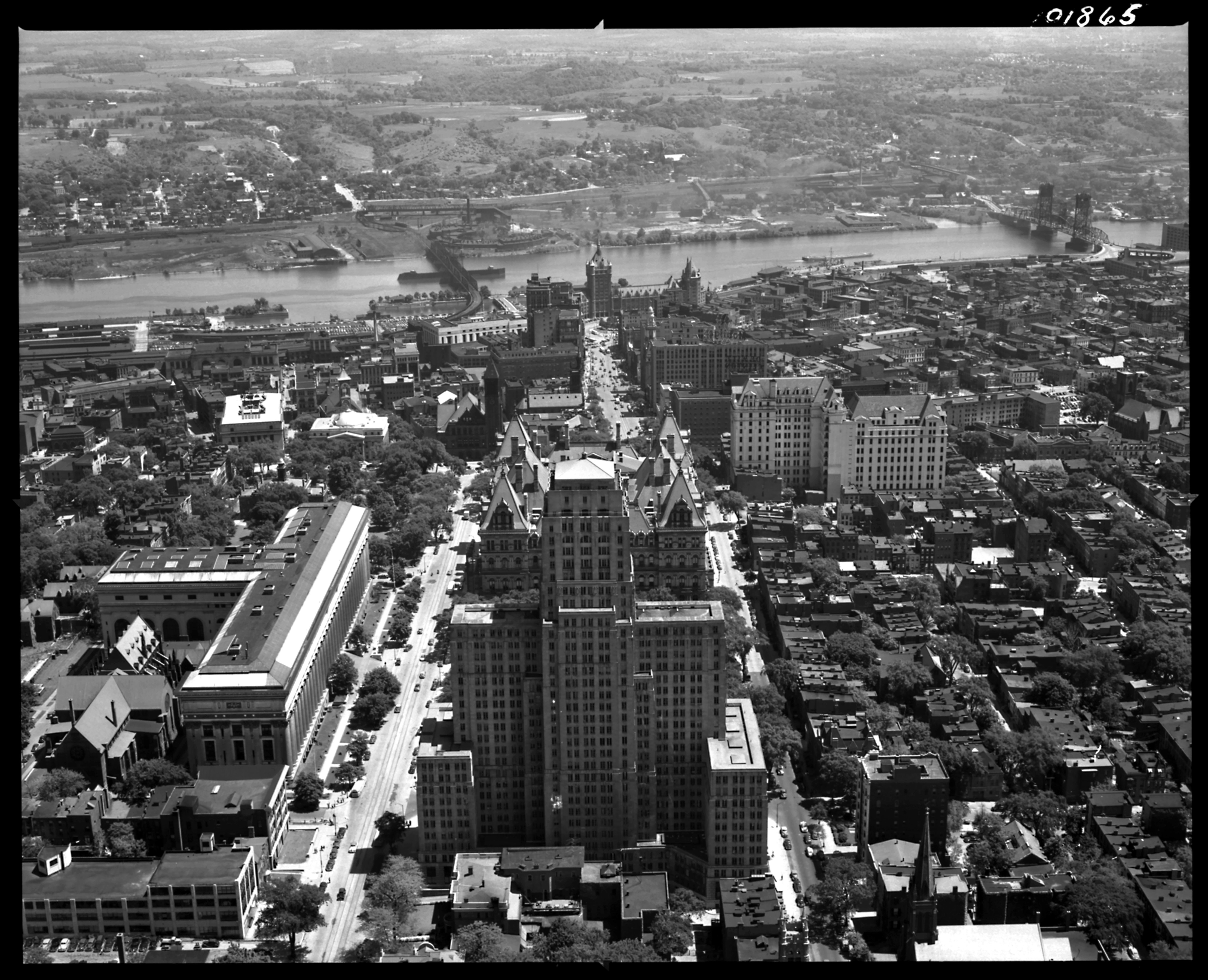
Yeah, so that looks familiar. Front and center, the Alfred E. Smith Building, from this angle all but obscuring the State Capitol. To the left of that, the majestic State Education Building, which from nearly all angles obsures (intentionally) the Episcopal Cathedral of All Saints to its left. Just to the right and beyond the Capitol is the New York Telephone Building (here revealed to have an interesting jog in its structure, now obscured by its own annex). Beyond that, if you zoom in you can see the sign of the DeWitt Clinton Hotel, and the old Mobilgas sign just beyond that; but those are gone. On down the way, next to the river, the Delaware and Hudson Railroad headquarters (now SUNY headquarters); that’s still there. Go ahead, click on the picture and zoom in … it’s the gift that keeps on giving.
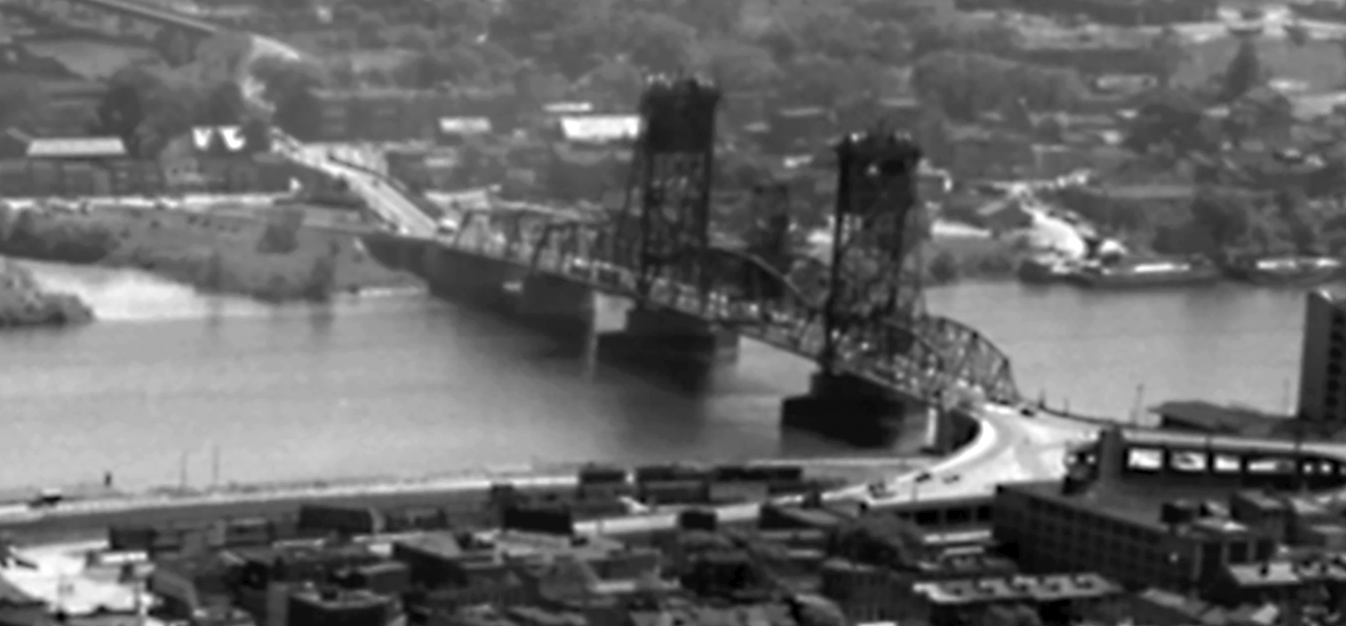
For starters, there’s the Dunn Memorial Bridge. The real one. The one that opened in 1933, replacing the previous Greenbush Bridge, and was blown up in 1971 to make way for a soulless replacement that was meant to be part of an expressway that never happened.
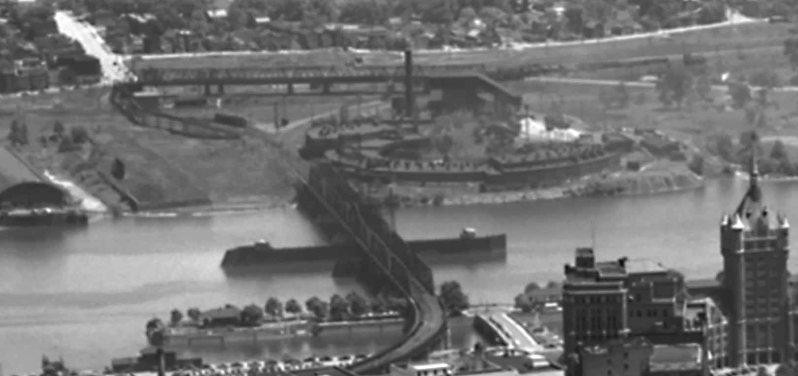
To the north, another bridge that is gone: the Maiden Lane Bridge, which carried rail traffic between East Albany (later Rensselaer) and Albany. It opened in 1871, five years after the first bridge (which now needed a name, and became the Upper Bridge, and later, the Livingston Avenue Bridge). As far as we can figure out, the bridge was torn down about five minutes after the last passenger train left Union Station in 1968. To its right on the other side of the river, the Rensselaer Roundhouse, completed for the New York Central in 1903. Ernie Mann’s book says the roundhouse was demolished in 1955. (If you wanted to reconstruct it, pretty detailed plans are available here. Get cracking.) The site later became the home of the Rensselaer High School, and is once again awaiting redevelopment.
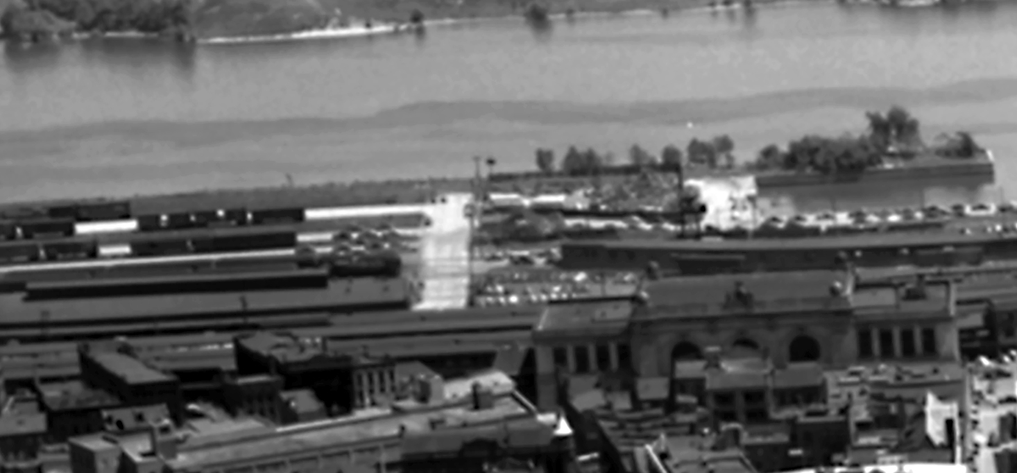
Just north of that, Union Station and the associated train sheds. The station, happily survives, but all of that track and shed area came down for the development of I-787 and Water Street, which is a long highway ramp that pretends to be a city street in that stretch. Directly north (left) of Union Station are buildings that were probably torn down around the time the rail lines were, and the lot sat empty for many years until the DEC building was built there, opening in 2001. Directly in front of the station are buildings that used to be the heart of rail commerce, but at some point they came down and the rubble-strewn lot was redeveloped into Tricentennial Park.
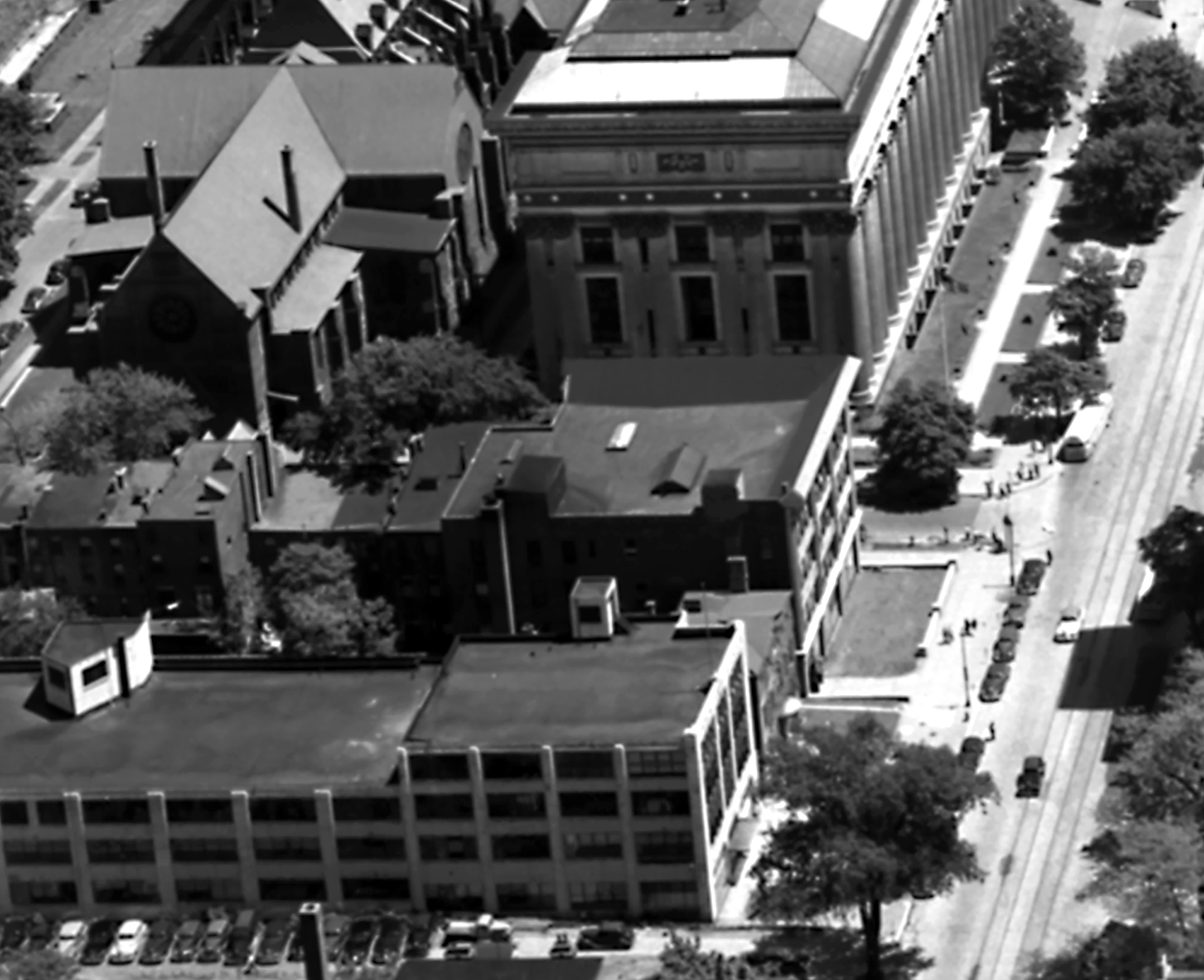
Yeah, these buildings across Swan Street from the State Education Building aren’t there anymore. They were replaced by One Commerce Plaza.
And, of course, all this is now the Empire State Plaza.