
Discussions about the tangle of aerial concrete that serves as downtown Albany’s highway system inevitably center on the blindness of the planners and urban “renewal” advocates who saved our cities by making it much easier to commute to them and much harder to live in them. And so we curse the visionaries of the ’60s and ’70s.
But perhaps it was inevitable, because there was a plan for an elevated highway in Albany as early as 1936. Granted, it lacked the pure dislocating power of what finally happened in the ’60s, but it wouldn’t have been a bad start.
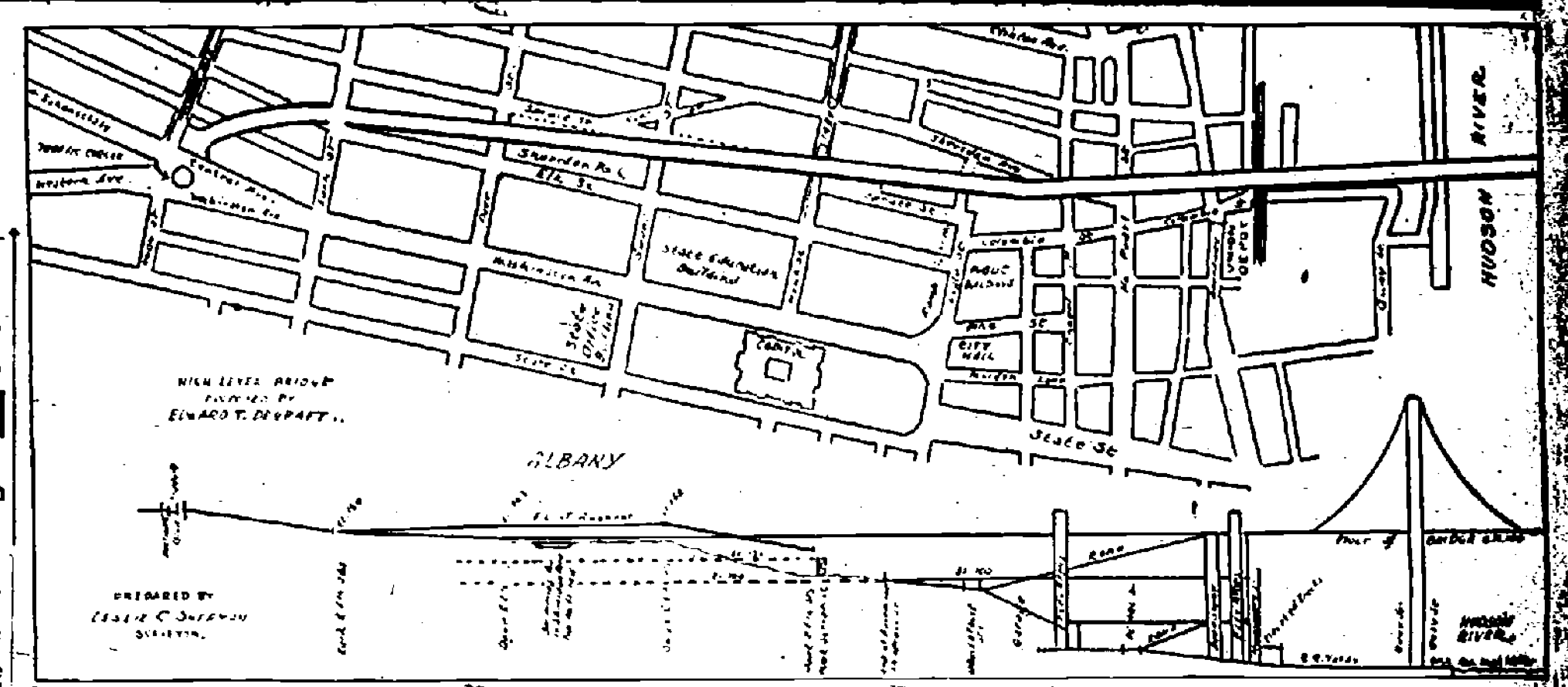
The Albany Evening Journal of August 3, 1936 includes a profile and surface plan “of the proposed elevated highway from the Hudson River over North Pearl Street and Hawk Street viaduct to the intersection of Northern Boulevard, Washington and Central Avenues.” That’s right, over the Hawk Street Viaduct. They were thinking big, Depression or not.
“Designed by Leslie C. Sherman from a plan by Edward T. DeGraff, the elevated highway would connect with a new high level bridge over the Hudson River to Rensselaer, where it would tie in with main highways. The profile indicates a suspension type of bridge, connecting just north of the Union Station with a highway at the same level. This would be built on steel supports westerly above Broadway and North Pearl Street, crossing above Sheridan Avenue and above Hawk Street viaduct. From that point the express highway would run almost on a level with Sheridan Park, passing above Lark Street and ending in a Plaza at Northern Boulevard and Central Avenue. Beneath the elevated highway garages and parking space could be provided. Ramps would lead off the elevated highway to Eagle Street and to Swan Street. The highway would have no intersections or traffic lights, and make possible a running time between Northern Boulevard and Broadway of but a few minutes.”
Let’s just be clear that “highway” in 1936 didn’t mean what it does today. The main highways described on the Rensselaer side would have been Columbia Turnpike and the Farmers’ Turnpike. I’d be curious to know how they planned to handle the bridge across the Hudson at a time when river traffic was still a serious concern, but perhaps a drawbridge would have sufficed.
Had this been built and the viaduct taken down, no doubt we’d have the local mystery of why the elevated was so darned elevated.