
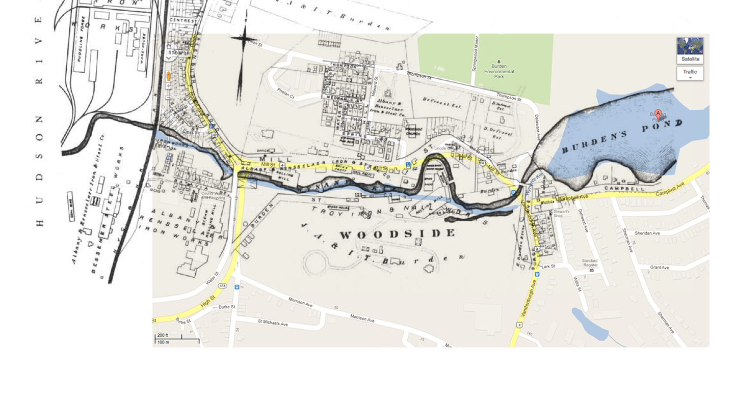
 So here’s an attempt to show just where the Troy Iron and Nail Factory and the rest of Burden’s burgeoning Upper Works were, which should give you an idea of just how much this tiny corner of Troy has changed and changed back — from wooded vale to center of industry to pleasant steep little street along a nearly forgotten set of falls. Click on the map for a larger view of an old map of the works overlaid with the current Google map. You’ll see that the Wynantskill has been straightened out a bit, with the removal of that oxbow on which much of the works was built. Burden’s Pond remains, as does the Woodside church just above the Oxbow. Factory buildings once lined the kill, but barely a trace of them remains today. And the only reminder of the greater water wheel that once powered all this is a mural on a concrete retaining wall at the bottom of the hill.
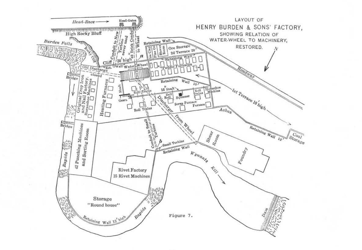 This diagram by the Society for Industrial Archeology from 1971 reconstructs the works. It’s oriented upside-down from the map above. You can see that the buildings were built right up against the creek, with bridges across it for access. This is the only diagram I’ve found that has a precise location of the Burden water wheel, which was a landmark ruin for longer than it was a functioning wheel, but of which no trace is found on the grounds alongside the kill today.
Want to know more about Henry Burden? Just follow these links:
- The Nail Factory
- The Nail Factory Cemetery
- The Immense Iron Mills of Henry Burden
- What Burden’s Works Looked Like
- Mr. Burden’s Water Wheel
- Henry Burden
- Behold Henry Burden’s Horseshoe Machine
- The Wonders of the Puddling Forge
1 thoughts on “What Burden’s works looked like”